


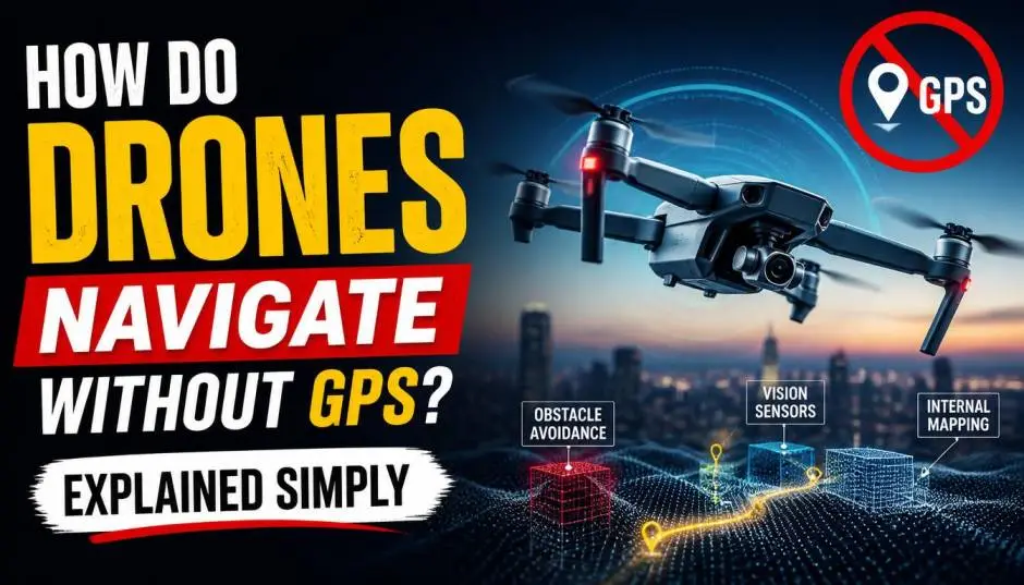
How Do Drones Navigate Without GPS? Explained Simply
How do drones navigate without GPS is one of those questions that keeps popping up in drone forums and pilot groups. I remember the first time I took a consumer drone into a parking garage. The GPS signal dropped within seconds, and the drone started drifting like a shopping cart with a wobbly wheel.
That experience got me curious. How do drones navigate without GPS when they lose satellite lock? The answer isn’t one single thing. It’s a combination of sensors, clever math, and sometimes even AI. Some drones use visual odometry. Others rely on inertial measurement units.
The really advanced ones do something called sensor fusion, mixing data from multiple sources to figure out where they are. GPS-denied navigation solutions have become a hot topic, especially as jamming and signal spoofing become more common. Let me walk you through how this actually works, based on what I’ve seen and tested.
What Happens When GPS Stops Working?
Most consumer drones rely heavily on GPS. It gives them position, velocity, and heading. Lose that signal, and the drone suddenly becomes dumb. It doesn’t know where it is. It doesn’t know which way it’s moving. It just knows it has power and motors.
Read Also: DJI Avata 360 Spec Review: Did the 8K FPV Leaks Match Reality?
I watched a friend’s DJI Mini enter “Attitude Mode” inside a concrete building. The drone started drifting sideways within seconds. Without GPS to correct the drift, the flight controller was flying blind. That’s the problem. GPS does more work than most people realise.
When the satellite fix disappears, the autopilot switches to memory. It remembers the last known position and tries to guess where it should be. But that guess gets worse with every passing second.
The Sensors That Replace GPS
Drones that navigate without GPS use a handful of onboard sensors. Each sensor does one job. Together, they create a picture of where the drone is and where it’s going.
Inertial Measurement Unit (IMU)
The IMU is the backbone of GPS-denied navigation. It measures acceleration and rotation. It tells the drone which way is up. It tracks how fast the drone is spinning. It detects every tilt and turn.
But IMUs have a problem. They drift. A tiny error in the gyroscope becomes a wrong angle. That wrong angle becomes a wrong velocity. That wrong velocity becomes a position estimate that’s completely off. Without something to correct it, the drone can drift hundreds of metres in just a few minutes.
Barometer
The barometer measures air pressure. It gives the drone altitude data. It’s surprisingly accurate for vertical positioning. But it can’t tell you where you are on a map. It only tells you how high you are.
Magnetometer
The magnetometer is basically a digital compass. It tells the drone which direction is north. It works well in open spaces. But metal objects, power lines, and even the drone’s own electronics can throw it off.
Optical Flow Sensor
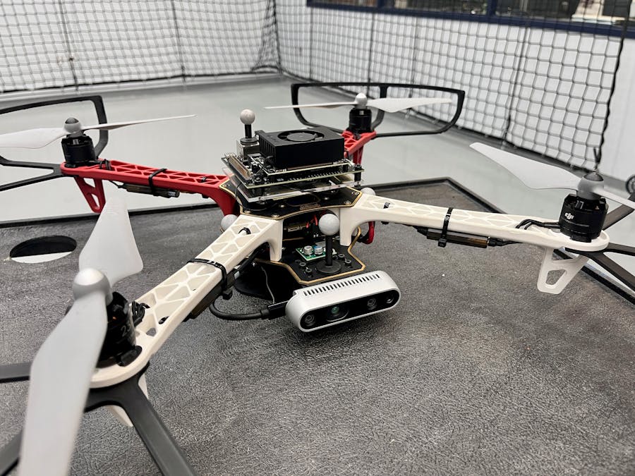
This is where things get interesting. An optical flow sensor works like the sensor inside a computer mouse. It points at the ground and watches how the surface texture moves between frames. That movement becomes motion data.
You Must Also Like: DJI Mavic 4 Pro Review 2026: The New 100MP King of Drones
If the drone drifts sideways, the optical flow sensor sees it immediately. The flight controller pushes back. This is the core of GPS-denied drift correction.
I tested a small drone with an optical flow sensor in a gymnasium. It held position remarkably well. Not perfect, but good enough for indoor flying.
Time of Flight (ToF) Sensor
Optical flow alone isn’t enough. The math changes with altitude. The same pixel shift means different real-world movement depending on how high you are. A ToF sensor fixes that by measuring the actual distance to the ground. It fires a laser beam and times how long it takes to bounce back.
LiDAR
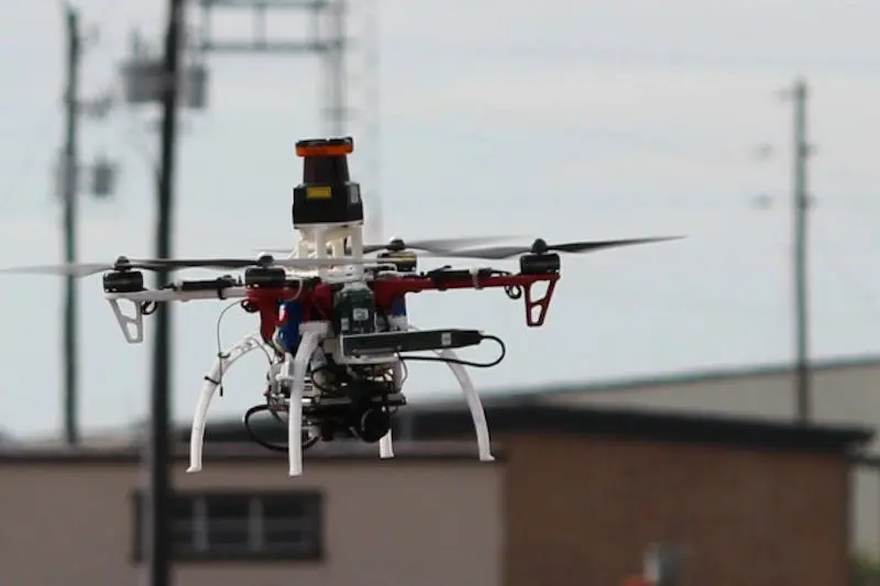
LiDAR is the heavy hitter. It shoots out laser pulses and builds a 3D map of the environment. Some drones use LiDAR for obstacle avoidance. Others use it for navigation.
A recent study showed that combining LiDAR with barometric and inertial data through a deep learning model called CLAK reduced navigation error from over 3 metres to under 1 metre.
Cameras
Cameras are everywhere on modern drones. They’re not just for photos. They’re for navigation. The drone compares live camera images with pre-loaded maps. It finds landmarks. It tracks features.
A system called MiFly uses radio frequency waves reflected off a single tag to help a drone self-localise indoors. Another system called Bee-Nav mimics how honeybees find their way home. It uses a neural network that requires very little computational power.
The Math Behind the Magic
Sensors alone aren’t enough. The drone needs algorithms to make sense of all that data.
Dead Reckoning
Dead reckoning is the simplest method. The drone uses its IMU to track movement from a known starting point. It adds up all the small movements. It calculates where it should be.
The problem is that errors accumulate. Every tiny measurement error adds up over time. After a few minutes, the drone has no idea where it really is.
Kalman Filters
Kalman filters are smarter. They take noisy sensor data and make it useful. They weigh the reliability of each sensor. They combine readings to produce a better estimate.
Think of it like this. Your IMU says you moved 10 metres forward. Your optical flow sensor says you moved 9.5 metres. Your camera says you moved 10.2 metres. The Kalman filter averages these out, giving more weight to the most reliable sensor.
Visual Odometry
Visual odometry uses camera images to track movement. The drone looks at a feature in one frame. It finds the same feature in the next frame. It calculates how much it moved between frames.
This works well in good lighting. It struggles in the dark or in featureless environments.
SLAM (Simultaneous Localization and Mapping)
SLAM is the gold standard. The drone builds a map of its environment while simultaneously figuring out where it is on that map.
The catch is that SLAM needs serious computational power. You’re looking at something like a Raspberry Pi 4 or an Nvidia Jetson. That’s not something you’ll find on a $100 toy drone.
Sensor Fusion
Sensor fusion is the real answer to how do drones navigate without GPS. No single sensor is perfect. But combine them, and you get something reliable.
A 2025 review of 132 papers on GPS-denied navigation concluded that hybrid approaches—mixing absolute and relative localisation—are the most reliable. The research team emphasised that “no single sensor or algorithm can solve all the challenges”.
How Military Drones Handle GPS Loss?
Do military drones use GPS? Yes, but they don’t rely on it exclusively. Military drones have been navigating without GPS for years.
The US Air Force successfully tested the “Osprey Mk III” drone with an alternative navigation system. The drone completed autonomous flight even under high-intensity GPS jamming.
Red Cat tested Palantir’s Visual Navigation software on the Black Widow drone. The drone completed a reconnaissance mission without GPS or human input.
Israeli company Asio Technologies developed the Nocta system. It combines inertial positioning, vision odometry, and image-to-map matching. It operates day and night. It has logged over 10,000 hours in real combat missions.
Taiwan’s AIDC unveiled AIxVNAV, a visual navigation system that uses satellite-derived 3D mapping and AI processing.
The trend is clear. Military drones are moving toward multi-mode navigation. They’re building redundancy into their systems.
What About Consumer Drones?
Consumer drones are catching up, but slowly.
DJI
DJI drones rely heavily on GPS. Lose the signal, and they enter Attitude Mode. They drift. They’re hard to control. Some DJI models have downward-facing sensors that help with position hold, but it’s not true GPS-denied navigation.
ArduPilot
ArduPilot is an open-source flight controller. It has built-in support for GPS-denied navigation. You can enable non-GPS flight by setting certain parameters. The system uses the Extended Kalman Filter (EKF3) to fuse data from multiple sensors.
I’ve seen hobbyists build ArduPilot drones that fly indoors using optical flow and LiDAR. It’s not plug-and-play. You need to know what you’re doing. But it works.
GhostPilot
GhostPilot is an open-source visual SLAM stack. It lets any drone fly indoors or in jammed environments without GPS. It’s built on ROS2 and uses VINS-Mono for visual-inertial odometry.
LiteWing
LiteWing makes a small add-on board for ESP32-based drones. It uses an optical flow sensor and a ToF sensor to hold position without GPS. It’s designed for tiny drones that can’t spare the weight for a GPS module.
The Limitations You Need to Know
GPS-denied navigation isn’t magic. It has serious limitations.
Drift
Without GPS to pull the estimate back, the drone drifts. The longer it flies, the worse the drift gets.
Computational Power
SLAM and visual odometry need serious processing power. You can’t run them on a cheap flight controller.
Lighting Conditions
Vision-based systems struggle in the dark, in fog, or in rain. They also struggle over uniform surfaces like open water or snow.
Cost
Good GPS-denied navigation hardware isn’t cheap. The Nocta system weighs under 250 grams and uses just 5 watts, but it’s a military-grade product. Consumer alternatives are getting better, but they’re still limited.
Buying Guidance for GPS-Denied Drones
If you’re shopping for a drone that can navigate without GPS, here’s what to look for.
Who Should Buy a GPS-Denied Drone?
-
Indoor flyers: If you fly in warehouses, parking garages, or buildings, you need GPS-denied navigation.
-
Search and rescue operators: You might need to fly in canyons or dense forests where GPS is weak.
-
Hobbyists and researchers: If you’re building your own drone, ArduPilot with optical flow is a good starting point.
-
Commercial inspectors: Inspecting bridges, tunnels, or industrial sites often means flying without GPS.
Who Should NOT Buy One?
-
Casual flyers: If you only fly in open fields, GPS is fine.
-
Budget buyers: GPS-denied navigation adds cost. Don’t pay for features you won’t use.
-
Beginners: Learning to fly with GPS is hard enough. Don’t make it harder by removing GPS.
What to Look For?
-
Optical flow sensor: Essential for drift correction at low altitudes.
-
ToF or LiDAR: Needed for accurate altitude measurement.
-
Camera for VIO: Visual-inertial odometry gives you better position estimates.
-
Processing power: Look for a drone with an onboard computer, not just a flight controller.
-
Open-source firmware: ArduPilot and PX4 give you more control over GPS-denied settings.
The Future of GPS-Denied Navigation
The market for GPS-denied drone navigation is growing fast. It’s forecasted to grow by over $27 billion between 2025 and 2030.
AI is playing a bigger role. Researchers are using deep learning models like CLAK to localise drones using only non-visual sensors. Others are using reinforcement learning for navigation in GPS-denied terrain.
Quantum-enhanced sensor fusion is also on the horizon.
The reality is that GPS-denied navigation solutions are no longer a niche. They’re becoming a baseline requirement. As one developer put it, “drones that can’t fly without GPS are already obsolete in contested environments”.
The Final Thoughts
I’ve flown drones with and without GPS. The difference is night and day. With GPS, everything is easy. The drone holds position. It returns to home. It follows waypoints. Without GPS, you’re back to flying manually. You’re constantly correcting drift. You’re watching the drone like a hawk.
But here’s the thing. GPS fails. It fails indoors. It fails in cities. It fails when someone points a jammer at it. Learning how do drones navigate without GPS isn’t just academic curiosity. It’s practical knowledge.
If you’re serious about drones, learn the basics of sensor fusion. Understand what an IMU does. Know the difference between optical flow and visual odometry. It’ll make you a better pilot. It’ll help you choose the right drone. And it might just save your drone when GPS lets you down.
FAQ's- GPS-Denied Navigation Solutions
Can a drone fly without GPS?
Yes. Many drones can fly without GPS using optical flow, visual odometry, and inertial sensors. Consumer drones like the DJI Tello use optical flow for indoor position hold.
How do drones know where they are without GPS?
They use a combination of sensors—IMU, barometer, magnetometer, optical flow, cameras, and sometimes LiDAR. These sensors feed data into algorithms like Kalman filters and SLAM to estimate position.
Do military drones use GPS?
Yes, but they don’t rely on it. Military drones use multiple navigation systems including inertial navigation, visual odometry, and terrain matching. They’re designed to keep flying even when GPS is jammed or spoofed.
What is GPS-denied navigation in ArduPilot?
ArduPilot supports GPS-denied navigation through its EKF3 estimator. You can enable non-GPS flight by setting AHRS_OPTIONS parameters. The system fuses data from IMU, compass, barometer, and external position sources like optical flow.
How accurate is GPS-denied drone navigation?
It depends on the sensors. High-end systems like Nocta claim precise positioning even during complete GNSS blackouts. Consumer-grade optical flow systems are less accurate but sufficient for indoor hovering.